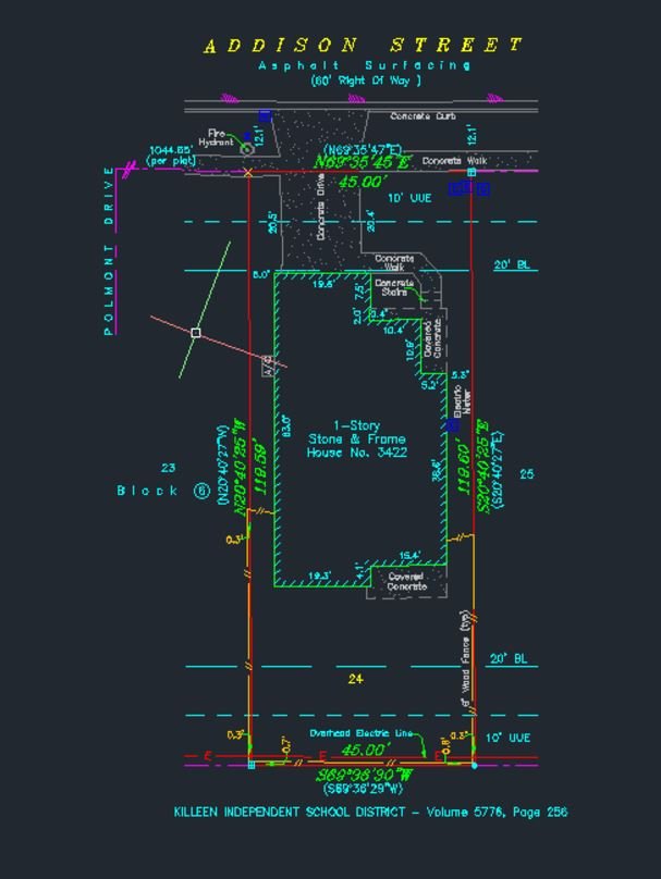
We leverage cutting-edge tools to deliver unparalleled accuracy, efficiency, and value to our clients. Discover how we combine technology with expertise to exceed expectations.
Our drones provide aerial imagery and topographical data with unmatched speed and clarity.
Client Benefit: Efficient mapping of large areas, saving time and reducing costs.
Using high-precision laser scanners, we capture detailed 3D measurements, ensuring accurate data for your projects.
Client Benefit:Faster surveys with greater accuracy, reducing costly errors.
Advanced GIS software allows us to analyze and present geospatial data for comprehensive insights.
Client Benefit: Clear visualizations and data-driven decision-making.
We utilize CAD software for detailed designs, layouts, and construction plans.
Client Benefit: Precise designs that align with project specifications.
Back to Home